Nicely done CMDR.
Any ideas on the correct displacement angle to put into my calculator (even if it changes per radius)? I can fiddle it to get a match for each site, but I'd like to predict rather than work backwards for future sites.
http://i.imgur.com/hYGAw0K.png
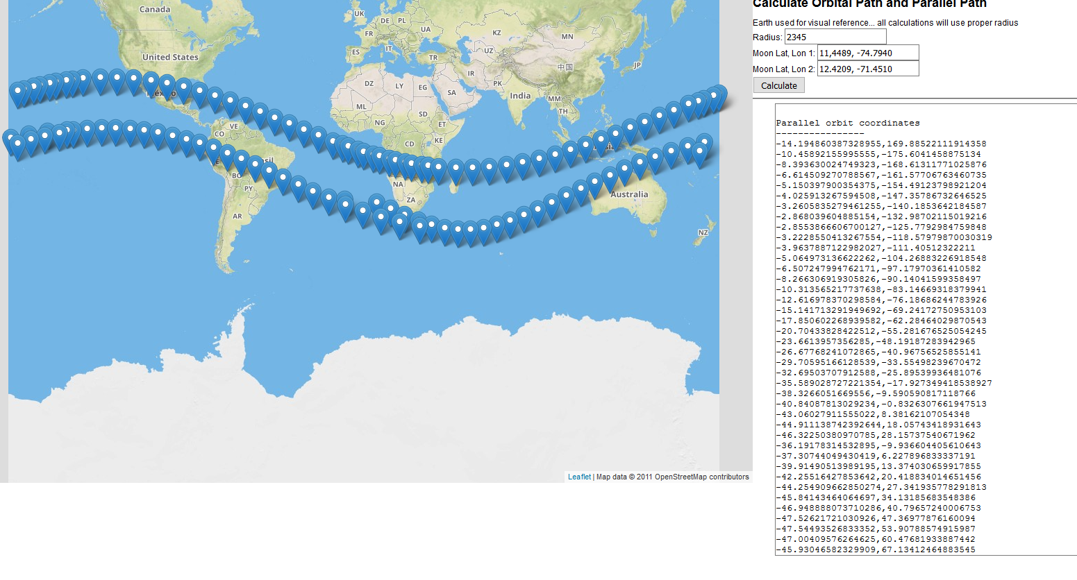
This tool predicts and is for use in surveying new sites. I just used a known site as a working example. So on a new site enter the 2 lat/lon coordinates from the moon and the radius.
Here's what it does.
1. Use coordinate 1 and coordinate 2 to get a bearing.
2. Use this bearing and coordinate to generate a great circle arc
3. Taking the original bearing if it's greater than 180 then the orbit is moving in such a way that the ruin will be southward. Otherwise northward.
4. Get 44% of the radius. This will be the distance to use in km from each given point.
5. Continually add km in distance to this great circle from step 2 and get the new coordinate. That's a point on the sphere. Repeat this process for the for every x km in the diameter. This actually just gives us half the points.
6. For each new point get its bearing. rotate plus or minus 90 degree and then get a new coordinate from that bearing that is the offset distance we calculated in step 4. This new point is the point in our parallel orbit.
Repeats the above the antipodal which gives us the other half and also ensures our coordinates are ordered in such a way that they are seamless.
- - - Updated - - -
Yeah, it looks awesome!
Been trying to get my head around it for the last 10 mins - my brain is putty atm, been a long hard day and some fool stayed up half the night chasing moons

Thanks for the heads up, I'll see if I can get to grips with it tonight.
Mine is definitely putty. It wasn't until I visualized it on a map that I saw what I was doing wrong.
- - - Updated - - -
Wow--I think you posted this while I was typing my question. If it hasn't been answered by tonight, I'll check it out myself! I was halfway done with a calculational tool that wasn't nearly so nice, but I suppose I should get back to work.
Thanks. I've been doing this for days. At first I was focused on finding intersections of bodies. Didn't hit me at first that the ruins would be offset in order for them to line up.