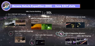
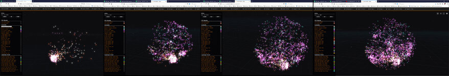
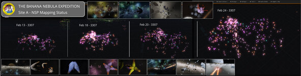
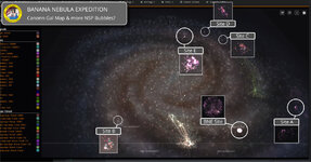
15 Months worth of ED/EDO Screenshots - Why post 1 photo at a time when I can post over 2000.

To be clear - The album represents my screenshots, taken while mapping 3 NSP bubbles of 6 that the PG is currently mapping, or have scouted with the intention of mapping in upcoming expeditions. The majority of our data is submitted via 3rd Party tools and goes into the Canonn Galaxy map (as shown in the attached image). It should also be noted that not all of this data in the map has been captured by our PG. Many CMDR's have flown through these sites, capturing data, not realizing what they missed.
 

Attachments

  • BNE STATS JUNE 3307.jpg
    BNE STATS JUNE 3307.jpg
    158.7 KB · Views: 62
  • Canonn Map Evolution dec 24th 2020.jpg
    Canonn Map Evolution dec 24th 2020.jpg
    496.9 KB · Views: 73
  • SITE A - Mapping Feb24 3307.jpg
    SITE A - Mapping Feb24 3307.jpg
    111.8 KB · Views: 54
  • Canonn Map OTHER nsp sITES 02022021.jpg
    Canonn Map OTHER nsp sITES 02022021.jpg
    158.6 KB · Views: 82
Back
Top Bottom