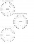
I too use the compass, but think that it would be nice to have an idea where your pad will be way out at ~7.5 km when docking access is granted, especially if you're in a hurry, perhaps carrying contraband. I love the pad map in the original post in this thread, but figured that (since I'll only be flying one ship at a time) individual maps for my current size of ship would be easier to scan. I manipulated the original Landing Pad Location map, and made three individual maps that will print out on one sheet of paper.
Attachments
Last edited:

