I think you should have to fly over a planet and having different scanners equipped for different purposes. Depending on the kind of scanner, your height above the surface and the type of scanner you should get different accurate results and the heatmap should vary in it's resolution depending on that. More accurate map data should payout better than less accurate data.
Another idea would be to eject a satellite that will do the job for you in X amount of time. You could launch it from your cargo / fighter bay into an orbit and collect it when its job is done.
I'm totally against the dull "press button, get results" mechanics that are currently all over in the exploration part of the game. For example to actually finding scanners I would prefer if we would have to drop probes and then triangulate the planets, similar to finding anomalies like in EVE. Actually if ED would have a 3D star system map, the way the scanning in EVE works would be ideal for ED as well to discover new planets and other stuff. See the screenshot below.
I might be wrong, but AFAIR the original design proposal talked about heatmaps for scanning, for planets and as well for mining. I'm not surprised it hasn't made it in the so called "finished" game. But hey, there are 8 years left to complete it...
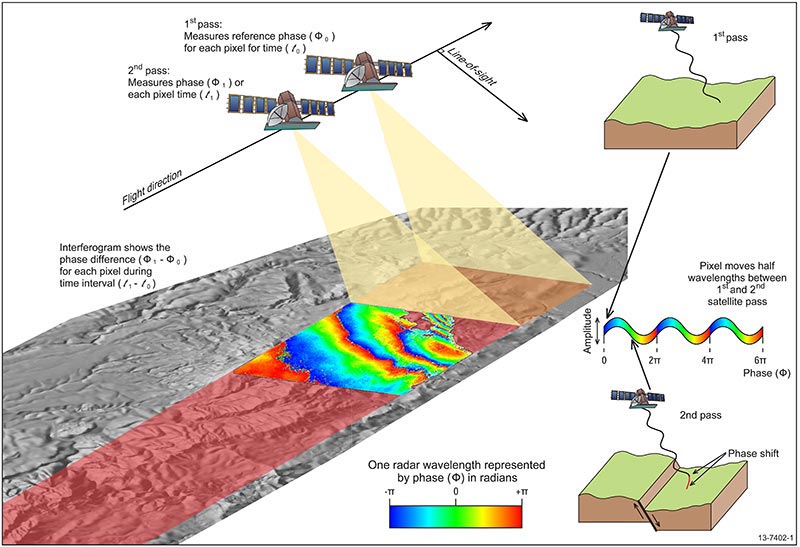
How a 3D surface scan looks and works today
and how it works.
http://www.ga.gov.au/__data/assets/image/0008/22859/13-7402-1-sml1.jpg
Semi-Realistic Surface Scanning from Kerbal Space (see
https://github.com/S-C-A-N/SCANsat):
https://camo.githubusercontent.com/...92e696d6775722e636f6d2f5645504c336f4e2e676966
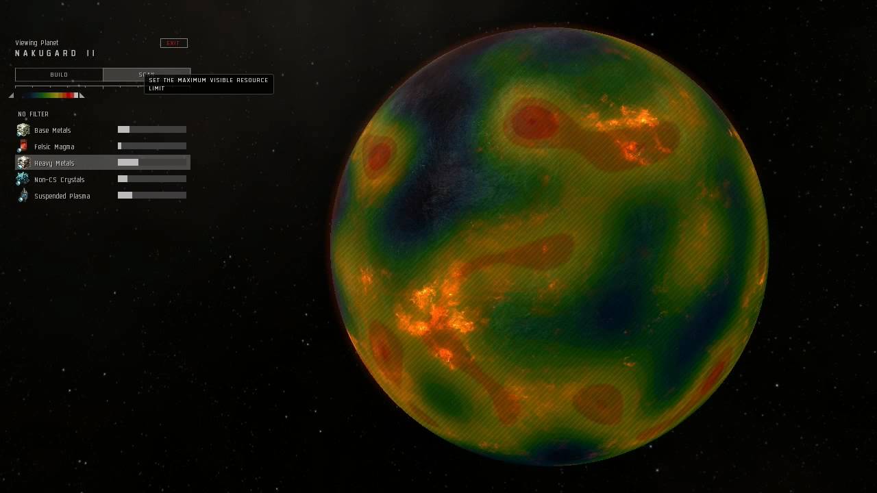
Heat Map from EVE Online:
https://i.ytimg.com/vi/slslQMplcf0/maxresdefault.jpg
Finding Signal Sources in Eve:
http://gischer.net/images/eve/ScanAway.jpg

")