Detailed Surface Scanner - What colour an I looking for for the signal sources?

I never have problems finding stuff, of course it does take a little bit of learning and understanding what sort of landscape the bio likes, it's not a gigantic arrow pointing at a plant and saying "here it is" so of course it won't suit all peoples playing style, but then some of us prefer not to have our hands held while exploring.

Good for you. I was talking about geologicals,

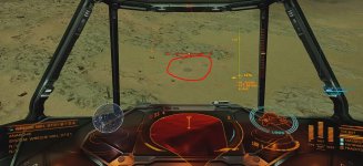
Once you know how the scanner works to segment geology it's redundant to a large degree, and you're still reduced to randomly scouring the surface to try and sight geological formations. At least in the SRV you had some sort of guidance. Based on recent experience I'm thinking geo formations are also spawned on SRV deployment, because I'm not seeing any from the ship, but when I land and deploy the SRV they magically appear in the same spot I just hovered over. Why can't the ship have a scanner like the SRV? It's totally illogical it doesn't.

But yes, please tell me again how bad hand holding it is requesting basic technology such as drones that can scan an area more efficiently to locate different types of object signatures, such as the ones we have in 2022. Yet here we are, in 3300++, and what do we have? 19h century manual search grid approach to finding things.
Yet somehow they have probes that can scan a whole planet in 30 seconds with 2 or three shots, but only to give you a dartboard to play with and a pair of 10 sided dice.

How hard is it to put in different filters for heat or other criteria, to show things up against a wider background. Don't answer that, it was rhetorical.
 
Last edited by a moderator:
4 pages of feedback about the DSS saying exactly what I'm saying here, about the limp utility of the so called DSS "heatmap".

 
Last edited:
4 pages of feedback about the DSS saying exactly what I'm saying here, about the limp utility of the so called DSS "heatmap".

But it's NOT a ' Heat Map ' , it's a Height Map
 
But it's NOT a ' Heat Map ' , it's a Height Map
Partially true, but it's a "heat map" in the sense it's "supposed" to indicate the potential presence of a bio/geo entitiy according to some random factor.
But it's also not a strict height map either, that's more a byproduct of different colored terrain just bleeding through the mask it seems.

But whatever, the point is it's a rubbish mechanic just designed to waste a players time and draw out an activity that should be a lot more efficient in the 33rd century.
Ship/SRV has night vision, but no IR or other scanning capability to make the process of locating bio/geo entities more effective.
Instead you have to drive around aimlessly till something pops up on the SRV Geiger counter, then follow the needle. No UI indicators of detected types, you're supposed to memorise the distinctive visual and audio patterns yourself.

Yet you've arrived there on an a magical starship that can jump 10's of light years at a time (how simulation is that!), sucking plasma from a star to refuel (extremely simulation!), and scanning a whole star system from one single location and determining all the planets/entities composition while doing so (mega simulation and true to life!).

But to locate bio/geo entities you're reduced to driving around looking out the window while poking a virtual stick in front of you to see what it hits.
And asking for something more effective is considered "hand holding", instead of a logical request based on the other magical space tech?

It's just deliberatly nerfed to waste the players time.
 
Last edited:
Yet you've arrived there on an a magical starship that can jump 10's of light years at a time (how simulation is that!), sucking plasma from a star to refuel (extremely simulation!), and scanning a whole star system from one single location and determining all the planets/entities composition while doing so (mega simulation and true to life!).

But to locate bio/geo entities you're reduced to driving around looking out the window while poking a virtual stick in front of you to see what it hits.
And asking for something more effective is considered "hand holding", instead of a logical request based on the other magical space tech?

It's just deliberatly nerfed to waste the players time.
With this logic we should have auto...well, everything. Why I have to mine resources? Or transport them? Fly to another systems? AI drones should make everything for us! It is 3308!
You complain that it is waste of our time. Thanks to new generation I found much more diversed enviroment, instead 1 geo signal and next biosignal I can everything. Geysers and 3 different plants in 1 place. In guardian area I found even spouts, braintrees and ruins in 1 place. For explorers new way of bio/geo generation created unlimites possibilities. For materials farmers...well, I know coordinates of good crystal fields, if you want I can share them.

I agree only with fact, that heatmap should be true heatmap.
 
Worst scanning/discovery mechanic of any game, on any platform...... ever! Prove me wrong.

I've been gaming for over 40 years and I genuinely can't think of one that's worse. I know this to be the case because no other game with a scanning/discovery mechanic has ever made me so frustrated to the point where I have to stop playing or risk putting my fist through the screen. Its just soooooo bad.

Which lunatic thought that having a filter for different and distinct items to locate should be the same shade of the same colour......? I can only hope they no longer work for FD.
 
With this logic we should have auto...well, everything. Why I have to mine resources? Or transport them? Fly to another systems? AI drones should make everything for us! It is 3308!
You complain that it is waste of our time. Thanks to new generation I found much more diversed enviroment, instead 1 geo signal and next biosignal I can everything. Geysers and 3 different plants in 1 place. In guardian area I found even spouts, braintrees and ruins in 1 place. For explorers new way of bio/geo generation created unlimites possibilities. For materials farmers...well, I know coordinates of good crystal fields, if you want I can share them.

I agree only with fact, that heatmap should be true heatmap.

You do realise with better tools you can be orders of magnitude more efficient and effective at covering more of those so called 400 billion star systems in the same amount of time? All while having more fun managing a complex technical system.

I guess not. Lets just do it all manual busy work and waste time because that's realer than real, apparently.

I'm 500ly from the bubble myself atm (I refuse to play that dumbass thargoid grind war with the naff reset progress every week mechanic) and exploring away collecting some raw mats. That in no way negates my criticisms above, and in fact I'll double triple down on everything I've said. More tools, more technology systems, more fun, more coverage. It's not rocket science.
 
Last edited:
Thanks everyone. Big blue blob = wet finger in the air. It's down there somewhere. Go find it.

And to see and find things on surface, cruise not higher as 200 meters over the surface. Best is to keep the altitude in cruise while seeking between 100 and 200 meters.
Bacteria are always circles on ground in a different colour as the ground.
 
And to see and find things on surface, cruise not higher as 200 meters over the surface. Best is to keep the altitude in cruise while seeking between 100 and 200 meters.
Bacteria are always circles on ground in a different colour as the ground.
Even then some BIOs are difficult to see from the air, but obvious when landing. e.g. the small bushes such as Frutexa
 
And to see and find things on surface, cruise not higher as 200 meters over the surface. Best is to keep the altitude in cruise while seeking between 100 and 200 meters.
Bacteria are always circles on ground in a different colour as the ground.
some bacteria are almost impossible to see on redish/rusty planets, even when you step on them (on foot)
for these, i rely on the ship scanner (when it emit a sound indicating something is in range to scan)
not my idea of fun
 
And to see and find things on surface, cruise not higher as 200 meters over the surface. Best is to keep the altitude in cruise while seeking between 100 and 200 meters.
Bacteria are always circles on ground in a different colour as the ground.
to be fair distance of render is bigger issue, than lack of giant blue circles "land here, it's signal".
 
Attached picture is just an example for a bacteria. How one can identify these from ship on altitude of 127 m.
Sure, to see it depends additional on your graphics card and the graphics settings of the game, how detailed you can setup these.
 

Attachments

  • Bacteria.JPG
    Bacteria.JPG
    179.9 KB · Views: 124
Last edited:
Attached picture is just an example for a bacteria. How one can identify these from ship on altitude of 127 m.
Sure, to see it depends additional on your graphics card and the graphics settings oft the game, how detailed you can setup these.

Or land and use an SRV and the external camera. You will get a more top down view. It depends on how many bacteria patches there are. For low numbers I would use the ship method that @Rob Galaxy suggests.
 
Attached picture is just an example for a bacteria. How one can identify these from ship on altitude of 127 m.
Sure, to see it depends additional on your graphics card and the graphics settings of the game, how detailed you can setup these.

That's an easy one to spot, 127m is to high, 100m max, around 50mps and a ship with a good downward view like a T6 or something and free headlook, you will find those are way easy to spot, I have seen them much harder.
 
So I did evidently miss the ""heat map"" is no longer BUT those imbecilic colors stayed and now Im absurdly confused, because there are just "bluysh" shades and that "greenysh-shades" (aquamarine) does not anymore mean Anything!?! That is just broken! Id think IF there is map of "more/less-likely-present" it MUST be JUST ONLY ONE color!
Am I just an idiot? because I read kinda a lot and I found no clear explanation WHAT NOW the colors mean, what difference is greenysh vs. bluysh shades... where the heck should i found those Spouts xD
 

Attachments

  • ED 206.jpg
    ED 206.jpg
    1.5 MB · Views: 59
Last edited by a moderator:
So I did evidently miss the ""heat map"" is no longer BUT those imbecilic colors stayed and now Im absurdly confused, because there are just "bluysh" shades and that "greenysh-shades" (aquamarine) does not anymore mean Anything!?! That is just broken! Id think IF there is map of "more/less-likely-present" it MUST be JUST ONLY ONE color!
Am I just an idiot? because I read kinda a lot and I found no clear explanation WHAT NOW the colors mean, what difference is greenysh vs. bluysh shades... where the heck should i found those Spouts xD
For geological you're best off switching to combat mode and eyeballing volcanic cones from orbit.
With biological the shades indicate some influence of the terrain on the life forms though it's not exactly clear what.
Best indication is competition between Fructis and Tussock where overlapping areas show opposed shading.
 
So I did evidently miss the ""heat map"" is no longer BUT those imbecilic colors stayed and now Im absurdly confused, because there are just "bluysh" shades and that "greenysh-shades" (aquamarine) does not anymore mean Anything!?! That is just broken! Id think IF there is map of "more/less-likely-present" it MUST be JUST ONLY ONE color!
Am I just an idiot? because I read kinda a lot and I found no clear explanation WHAT NOW the colors mean, what difference is greenysh vs. bluysh shades... where the heck should i found those Spouts xD
Here's what the devs have said:

Hey all, blue areas basically mean the organics can be found in those areas as they meet the conditions. It doesn't mean that every part of that blue area will contain the organics though.

The slight shading is just the planet topography underneath.

The slight shading is just due to the underlying topography. It has nothing to do with density of the organic or geology feature.

With experience you learn where stuff tends to show up (what sort of terrain), and then you look in the blue areas for that type of terrain.
 
Here's what the devs have said:


The slight shading is just due to the underlying topography. It has nothing to do with density of the organic or geology feature.

With experience you learn where stuff tends to show up (what sort of terrain), and then you look in the blue areas for that type of terrain.
The statement of devs seems kinda "shallow" :-D

So I will be doing what Im doing already... "guess" :-D
 
Back
Top Bottom