ED Astrometrics: Maps and Visualizations

It's not perfect of course, since there's no way to estimate how many more stars may have numbering higher than those that are known. But I figure that will mostly average out, and I just need a ballpark estimate of how thoroughly explored each area is.
In fact this is a well-studied statistical problem, known since WW2 as the German Tank Problem. For these purposes you can get away with the simple unbiased estimator for the maximum value in an unknown sequence, N̂ ≈ m + m/k - 1, where m is the highest number seen in the sequence, and k is the number of samples. So e.g. if a given boxel has 5 systems in the database, and the highest number is 20, then you can estimate that there are about (20 + 20/5 - 1) = 23 systems in that boxel.

Of course the estimate is fairly meaningless if you have only one or two systems seen (the linked article talks about confidence intervals, which get quite large for very small k), but the nice thing about it being an unbiased estimate is that the errors really will wash out when averaged over a bunch of sparsely sampled boxels.

Even so, I can already say that the saturation map you're producing feels generally correct. At least the places I've been that are red were places where it felt like there were very few untagged systems - e.g. when I was there after DW2 I was surprised at how thoroughly the far western Abyss was already explored.

Instead maybe I should assume exploration is 100% at Sol, and average in a gradient from there, fading out to zero effect at around 600 ly or so. Everything within 500ly seems pretty reliably tagged these days.
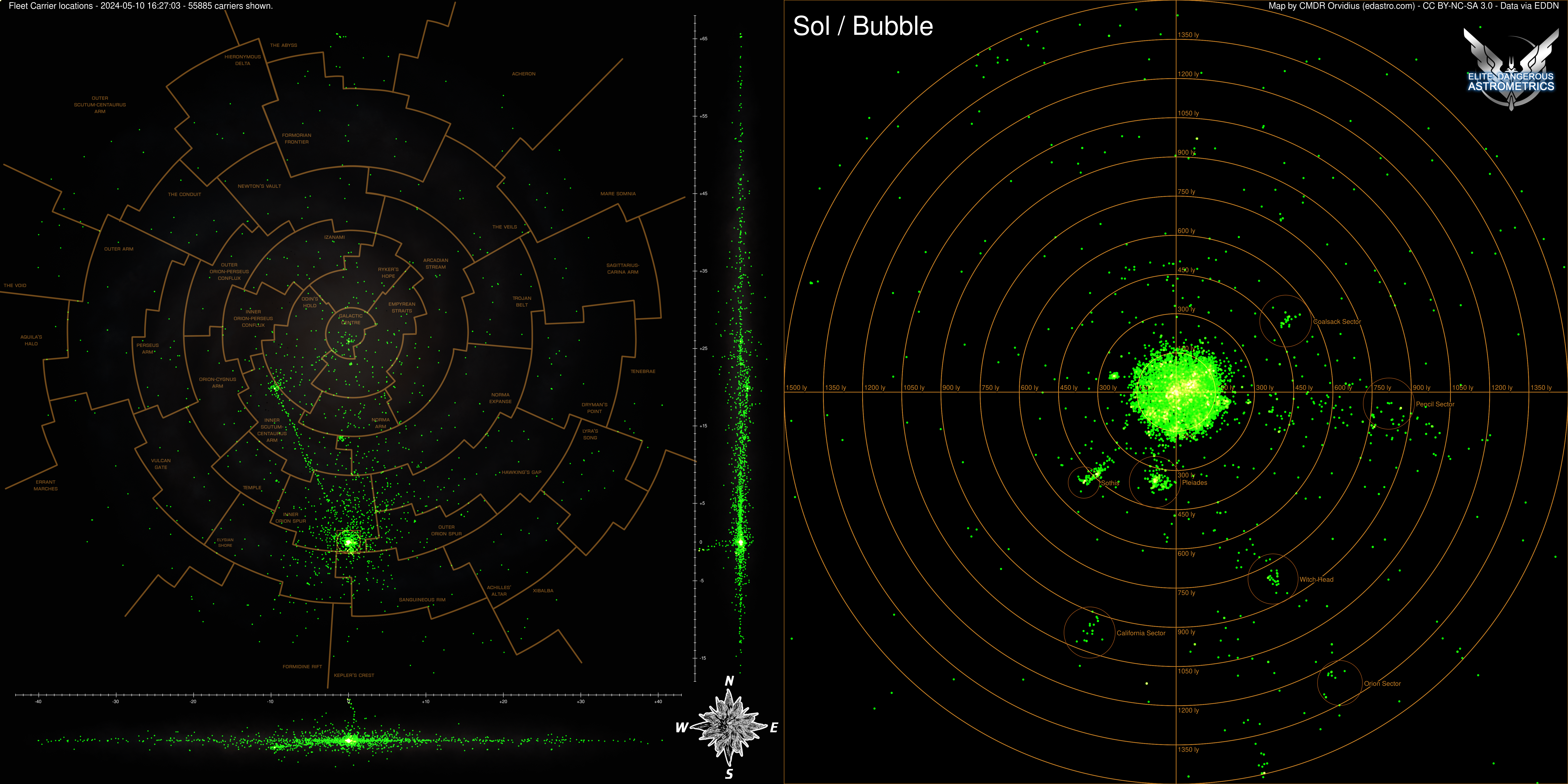
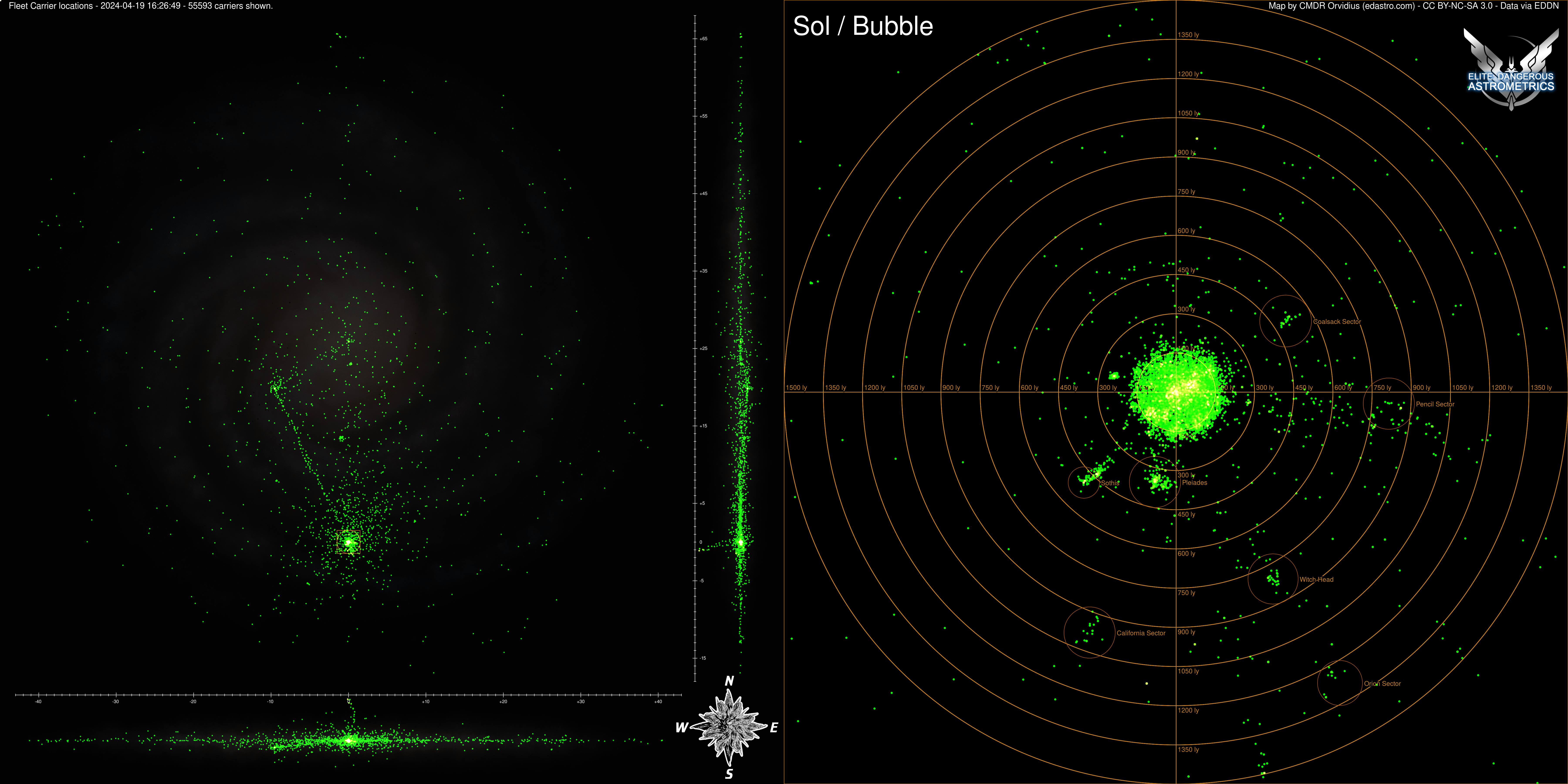
Agreed, it's extra headache for no gain to even try the calculation in the Bubble. It's a royal jumble of hand-placed systems and sectors, and it's all fully tagged anyway. I'd probably not bother doing the computation within 500 ly of Sol, and then kick in a gradient that falls to zero at about 1000 ly. That would keep the vast majority of the weird boundary issues and non-procgen systems safely out of consideration.
 
Yeah, it's really simple actually. I'm working out the combination of boxel system number sequences and looking for gaps. For instance, if we know of system numbers up to 100 within a given boxel (of whatever size/masscode), I can scan from 0-100 and see how many of those names are missing, and give an approximate percentage that way. It's not perfect of course, since there's no way to estimate how many more stars may have numbering higher than those that are known. But I figure that will mostly average out, and I just need a ballpark estimate of how thoroughly explored each area is.

Where this completely breaks down is in the sectors where only a handful of people passed through. We don't have data on most of the boxels there, and this results in very "grainy" (noisy) results in the map. There are many arm gaps that look this way. It will improve over time as more people explore out there.

EDIT: So it's not a separate "density" calculation at all. Rather it automatically takes that into account by estimating a percentage of exploration, unlike the other maps that just plot a direct count of systems known.

Ok, that makes sense.

If it helps, Jackie Silver and I did a big survey of Phleedgoea recently, and more specifically made sure to scan the final numbered system of every boxel E and above. I did the same in Scaulua. Might be useful to have some hard numbers on stellar density just to see how they compare.

Some interesting tidbits to come out of all this. Most system numbering follows a pretty regular pattern, I believe depending on where you are in relation to the Core and the galactic plane. So in the case of Phleedgoea the number of systems in a boxel would decrease by around 3.5% as you moved 'west' (Eg. VZ-O e6 ends in 884, UZ-O in 851, TZ-O in 792, etc.) and by increasingly larger percentages as you go 'south' starting at around 6.5% from e6 to e5 and dropping as much as 32.25% from e1 to e. However there were also a significant number of boxels (around 63 I think) that had numbers 12-14x higher than expected.
 
Ah, the German Tank Problem! I knew there was a historical example that I couldn't quite think of. Awesome. But yeah, I was only going to go down that rabbit hole if it proved necessary, but the early tests of the map were showing that the concept was working as-is. As long as it gets the general point across about where it's extremely difficult to find pristine untagged systems, than I've done my job. :)
 
Some interesting tidbits to come out of all this. Most system numbering follows a pretty regular pattern, I believe depending on where you are in relation to the Core and the galactic plane. So in the case of Phleedgoea the number of systems in a boxel would decrease by around 3.5% as you moved 'west' (Eg. VZ-O e6 ends in 884, UZ-O in 851, TZ-O in 792, etc.) and by increasingly larger percentages as you go 'south' starting at around 6.5% from e6 to e5 and dropping as much as 32.25% from e1 to e. However there were also a significant number of boxels (around 63 I think) that had numbers 12-14x higher than expected.
Can confirm this (though without having calculated exact percentages) based on an ongoing D-boxel survey not far from there.
 
Good idea on the bubble too. Are you going to make videos of daily shots perhaps? Might look pretty cool, at least in the beginning.
 
I'm storing a travel history in addition to current positions, so I can always think about animating later. I suppose daily snapshots of the map wouldn't be hard either.
 
Added maps for tracking carriers around the galaxy and the bubble. If I've set things up correctly, this should start auto-populating when carriers are released. Two versions, with and without region lines. Click to expand, as usual:


Oh that IS a good idea! One thought though - I might make the Bubble detail area span a bit wider range. As is, two jumps would take a carrier off the plot. In particular, I'd extend it south to at least 1100 LY (to encompass the clusters we'll likely get in the California Nebula and around Orion) and east 1200 LY (to encompass Guardian space out to Regor).
 
Huh, interesting idea. I was thinking of tightening it to get more detail inside the bubble, but that's not a bad idea either. Maybe a nice round 1500 radius might do the trick.
 
Alright, I've expanded the bubble view to a radius of 1500 lightyears, and I have the script set to run daily, and save date-stamped copies of the images for future use. I also am letting it save the PNGs at the full rendering resolution rather than cutting it in half before uploading.

EDIT: As an aside, I think this will look really cool when we start getting a lot of carriers. At the full resolution you can see that each dot is actually a circle. I'm pasting the dots in with "screen" compositing, and the color is set to "2,255,1" instead of "0,255,0" so that when they overlap a lot, the colors will gradually add up through yellow and white, in theory.
 
Two whole days and nobody's made it to Beagle yet. They're spreading out in a proper hurry though!
bp.png


well ;)
 
I'm considering this to be a "beta" feature at the moment, but I've added capability on the interactive map to import your own custom map markers. You just have to provide it with a URL to a JSON file that contains them, like this:

https : //edastro.com/galmap/?custom=<URL>

(spaces added around the colon to keep the forum from trying to make it clickable) :D

Details for the format and available marker pins here:

 
Hey, shout out to you Orvidius for providing an ever-growing library of maps and interactive maps!

I do have a question for you, though - Glowing Green Giants. Over at the GMP they're ambivalent on adding more POIs for additional GGG's, as most are really not that exceptional other than being technically GGG's. A while ago on the Perseus Reach Expedition I was fortunate enough to find one in Newton's Vault, but made no plans to submit a GMP entry. (I did update the folks tracking Glowing Green Giants over in their main thread at https://forums.frontier.co.uk/threads/glowing-green-giants-the-definitive-list.418336/ )

Recently I noticed that you have a filter on the interactive galaxy map to show the GGG's. I recognized that you're running those pins off the GMP list. So my question is; to add newly found GGGs, should we continue to submit GMP entries?
 
Top Bottom