Quality of Life Improvement: Input LAT/LON Co-ords and have a Surface Waypoint appear, similar to the surface scan mission Waypoint.

Status
Thread Closed: Not open for further replies.
A while ago I'd put in a feature request for just this function inside the "navigation" panel on the left. [Check out my previous post]


Basically this -> Surface navigation computer.


Input target LAT/LON info and it generates a heading caret on the compass in ship and SRV. Or if still in orbit/glide, it generates a target circle like we currently have for surfaces bases.
Until then. there's this -> http://edbearingcalc.neocities.org/


The advantage of being "built in" is that your present LAN/LON would already be known to the Surface Nav Comp and you'd simply enter your target (where you want to end up) LAT/LON in two fields and a direction caret would appear on your compass indicator. Your vector would also then be updated live. Logical to include a "Distance to waypoint"

Yeah we need something like it.

Also there's this in my app. - without a live update but it is still helpful. :/

5TO07g6.png


And there's also the E.D.I.S.O.N. app which is the live one using OCR from screenshots during the live game.
 
Genar-Hofoen, yea I saw E.D.I.S.O.N. and played with it. Pretty cool thinking outside the box to get the "source" cords via screen scrapes, but I thought it lacked the same bit of creativity with the interface being a plain white, square box on top front of everything. Could have done (perhaps) a transparent background and used ED'ish fonts or maybe this with a 2nd, separate display with just the direction heading to keep onscreen real estate in check. Just my opinion. All of these lack the benefit of being able to get the "source cords" from the client itself cutting out 50% of the pilot's workload to navigate. It just seems logical IMO.

Kind of like a better cargo load/unload interface than just holding down a single button until the desired cargo amount is displayed. Zero creativity there.
 
Last edited:
A while ago I'd put in a feature request for just this function inside the "navigation" panel on the left. [Check out my previous post]


Basically this -> Surface navigation computer.


Input target LAT/LON info and it generates a heading caret on the compass in ship and SRV. Or if still in orbit/glide, it generates a target circle like we currently have for surfaces bases.
Until then. there's this -> http://edbearingcalc.neocities.org/


The advantage of being "built in" is that your present LAN/LON would already be known to the Surface Nav Comp and you'd simply enter your target (where you want to end up) LAT/LON in two fields and a direction caret would appear on your compass indicator. Your vector would also then be updated live. Logical to include a "Distance to waypoint"

Good idea, but Frontier would make it an internal class 2 slot...

Yeah we need something like it.

Also there's this in my app. - without a live update but it is still helpful. :/

http://i.imgur.com/5TO07g6.png

And there's also the E.D.I.S.O.N. app which is the live one using OCR from screenshots during the live game.

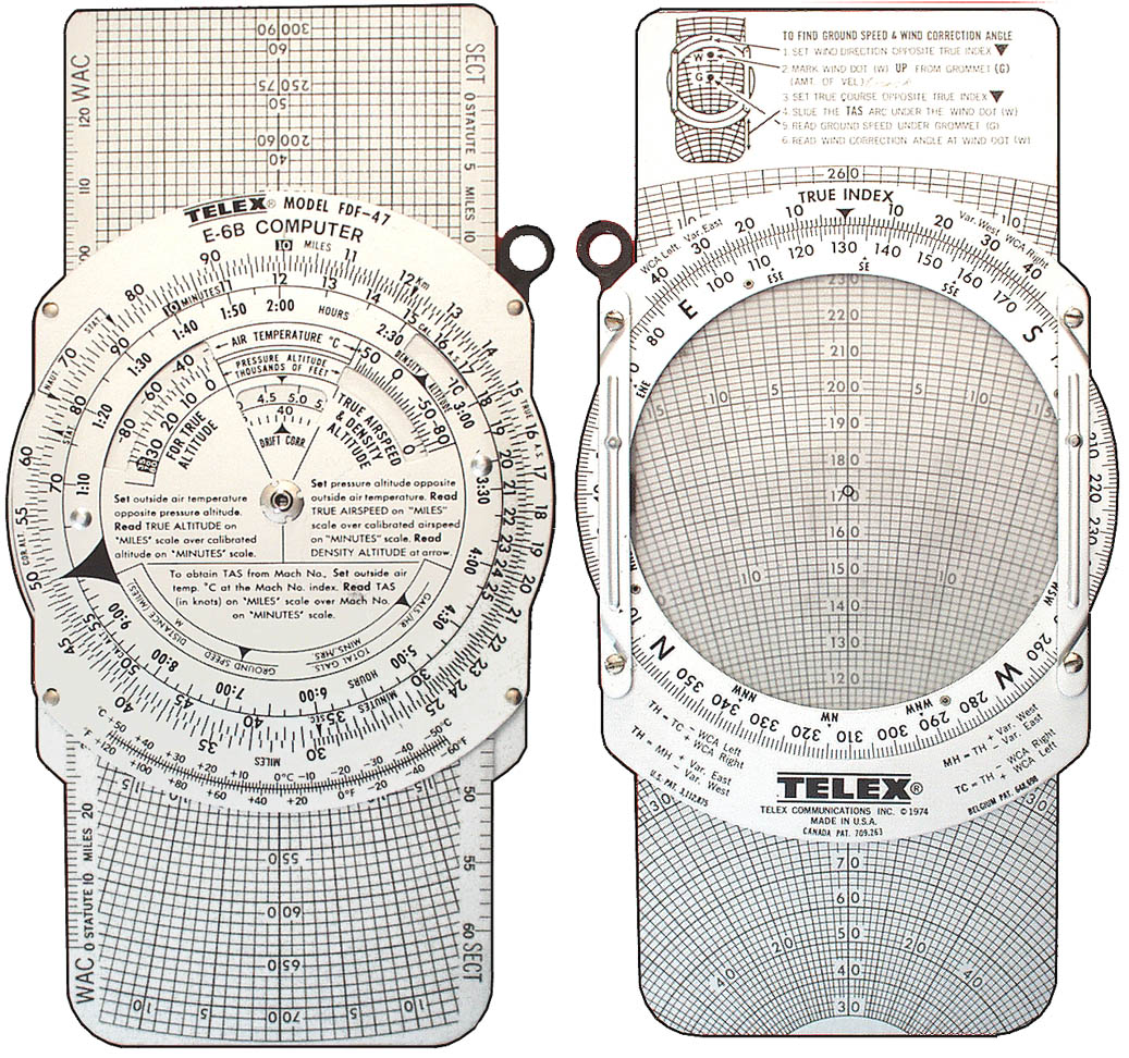
It's my old E4A wheel!
 
Just took me an hour to find a tip off mission. I had (falsely) assumed it would be an easy one and took my Keelback with the fighter just in case but wasn't expecting anything serious.

Finally get there and it's a huge base assault. That's ok, I have dumbfires and plasma on the fighter.

Oh and an Elite cobra with magic rails.

Died in a few seconds.

Don't mind dieing. Do mind wasting all that time getting there.

Please could we have an official comment?
 
21 pages and running for 2 months and still no dev comment?

2 months?

I posted my Sneak Peek - Surface Navigation thread on 3/4/2016. In everything that happened with that, including finally getting a response from FD (that they were not going to license apps as 'content' and the EULA rubbish), I did not receive one official comment on the functionality itself.

Since that time, there have been numerous other sites and apps that have provided navigation assistance in one form or another. There have also been many threads requesting a variety of navigation/bookmark improvements. I have yet to see one official comment on any of these.

I wouldn't hold your breath.
 
Dear People Who Decide What Gets Done in Frontier,

Planetary navigation is terrible.

This becomes apparent when trying to reach a set of LAT/LON coordinates on a planet surface, when there is no waypoint (like in a surface recovery mission).

Yes, very much please. Was unable to rep you more than once today so please have a virtual [up]
 
2 months?

I posted my Sneak Peek - Surface Navigation thread on 3/4/2016. In everything that happened with that, including finally getting a response from FD (that they were not going to license apps as 'content' and the EULA rubbish), I did not receive one official comment on the functionality itself.

Since that time, there have been numerous other sites and apps that have provided navigation assistance in one form or another. There have also been many threads requesting a variety of navigation/bookmark improvements. I have yet to see one official comment on any of these.

I wouldn't hold your breath.

I was talking about this thread specifically which is during a time when we are getting devs posting on the forum. It does look as though they are avoiding making any comment on this subject
 

Jenner

I wish I was English like my hero Tj.
What type? :)

Cessna 150 and 172. VFR only, and I only did it for a few years until it got too expensive and I just moved onto other things like a mortgage and a family. ;) I still kinda want to get back into it, though.

on topic: yeah, I agree that some love for planetary way finding would be welcome. :)
 
Last edited:
Cessna 150 and 172. VFR only, and I only did it for a few years until it got too expensive and I just moved onto other things like a mortgage and a family. ;) I still kinda want to get back into it, though.

on topic: yeah, I agree that some love for planetary way finding would be welcome. :)

Yes, I know the feeling about time and expense. I grew up flying, first in a Piper Tri-Pacer (!!), then a PA=28, then a Beech Debonair. IFR rated at 17.

Then came the Air Force, where I had to pretend I didn't know anything (instructors *love* breaking anyone who had any real time. Like Elite).

It's not just an adventure, it's a job. A grind job, with no hundred-dollar hamburgers or bathrooms at the next grass field. There is also a negative side... :(

Good to see someone who understand the frustrations of pilots, when faced with coders, who have never done even a walk-around. They simply would not be even be able to buzz around VFR, with the way they treat flying (except for combat).

Only SJA seems to "get it". Ah, well.

Thanks, Jenner.
 
I feel like I am the only nerd in the room who enjoys finding locations with lat/long...

*slinks away with slide rule*
 
Status
Thread Closed: Not open for further replies.
Back
Top Bottom